Winter storm watches upgraded to warnings across southern, central ...
Much of southern and parts of central Saskatchewan are under a winter storm warning, which was upgraded from a winter storm watch by Environment and Climate Change Canada (ECCC) on Friday.
Regina, Saskatoon, Moose Jaw and Swift Current are all included in the winter storm warning.
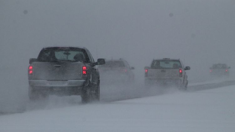
Between 20 and 40 centimeters of snow is expected along with wind gusts between 60 and 70 kilometres per hour, ECCC said.
The snowfall is expected to move in Saturday morning and carry through until Monday night, affecting most of the areas under the winter storm warning by Sunday.
Download the CTV News app for breaking news alerts on your mobile device“A low pressure system in Montana will bring heavy snow beginning in the southwest section of Saskatchewan on Saturday morning. Along with heavy snow, gusty winds will create blowing snow and reduced visibility. This area of snow and blowing snow will move northeast and cover the remainder of the southern half of the province by Sunday morning. Snow and blowing snow will continue through Monday,” ECCC said on its website.
ECCC also said conditions will be close to those of a blizzard in some locations.
Other parts of the province not included in the winter storm watch have been added to the warning, including Yorkton and Melville.
Areas remaining under a special weather advisory are still expected to see between 10 and 25 centimetres of snow by Monday afternoon, ECCC said.
Current updates to watches and warnings can be read here, Highway conditions can be seen here.


