Winter storm warning in effect for parts of the GTA
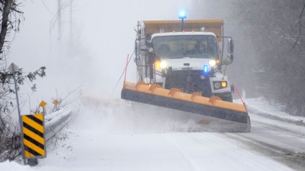
Some parts of the Greater Toronto Area are now under a winter storm warning ahead of a system that could dump up to 25 centimetres of snow beginning Friday night.
Environment Canada initially issued a winter storm watch advisory for Caledon, Uxbridge, Beaverton, Northern Durham Region, Newmarket, Georgina, and Northern York Region.
However, on Thursday evening, the federal weather agency upgraded the advisory to a winter storm warning.
“Snow is forecast to begin late Friday afternoon and will quickly become heavy at times, before transitioning to periods of rain Friday night as temperatures rise above freezing,” the advisory reads.
Those areas could see peak snowfall rates of three to five centimetres per hour. Environment Canada said 10 to 25 centimetres of snow could fall by the time it tapers off, adding that there is a risk of a short period of freezing rain Friday night.
The agency noted that strong southeasterly winds gusting up to 70 km/h are also in the forecast, significantly reducing visibility at times.
“While the prospects for a winter storm are high, uncertainty remains regarding the exact snowfall amounts at any given location,” Environment Canada said.
Following the storm, much colder Arctic air will descend across the region, which could result in a multi-day lake effect snow event, especially in locations east of the Great Lakes.
“Consider postponing non-essential travel until conditions improve,” Environment Canada said.
The advisory also includes portions of central and southwestern Ontario.
There are no alerts in effect for Toronto at this time. Friday’s forecast in the city calls for cloudy conditions throughout the day. Snow “at times heavy” is expected later in the evening before changing to periods of rain near midnight, according to Environment Canada.
Toronto could see five to 10 centimetres of snow. On Saturday, snow or rain is forecasted with a high of 1 C.


