Winter storm could bring up to 50 cm of snow to Atlantic Canada
Environment Canada has issued a winter storm warning for large swathes of Nova Scotia and Newfoundland, with up to 50 centimetres of snow expected in some areas.
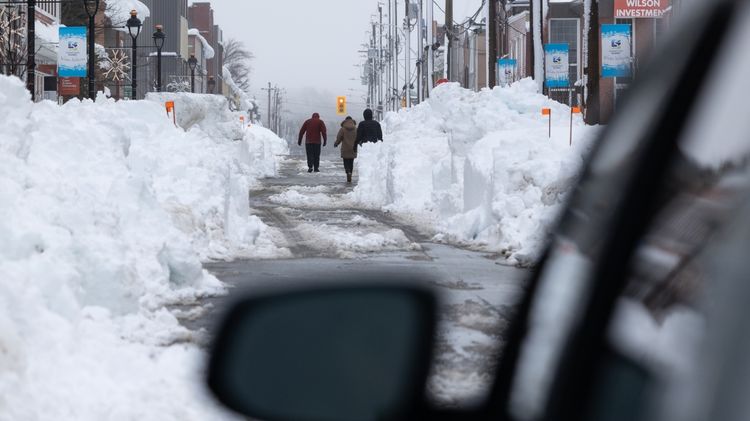
Southern and eastern Nova Scotia could see 15 to 25 cm of snow and wind gusts of 60 to 80 km/h as the powerful storm hits the province Tuesday afternoon through Wednesday morning. The highest snowfall is expected along Nova Scotia's Atlantic coast. Many flights to and from Halifax have already been cancelled.
Check your latest local forecast The information you need to know, sent directly to you: Download the CTV News AppEven more snow is anticipated in Newfoundland, with 30 to 50 cm in the forecast and the possibility of larger amounts in some areas. The storm is expected to impact Newfoundland from Wednesday morning until early Friday, with the heaviest snow arriving by Wednesday night. Two to three cm of snow per hour is possible in the province, with wind gusts reaching 80 km/h.
"Strong winds and fresh snow will likely give whiteout conditions to some areas," Environment Canada warned. "Winter storm warnings are issued when multiple types of severe winter weather are expected to occur together."
The hazardous winter conditions are being caused by a passing nor'easter, which is a type of North Atlantic cyclone.
The storm is also sweeping across the northeastern U.S., causing some airlines to cancel flights to and from cities like New York, New Jersey, Boston and Philadelphia.
In Newfoundland, storm surge warnings are also in place for St. John's and many other coastal communities, especially for northeast-facing shorelines. Waves from five to seven metres are expected during high tide late Wednesday night.
"Impacts from storm surge are expected, including coastal flooding, beach erosion, minor infrastructure damage, spread of coastal debris, and localized coastal road washouts," Environment Canada said.
Environment Canada has also issued snowfall warnings for southwestern Alberta, including Fort Macleod, Canmore, Kananaskis County and Waterton Lakes National Park. Heavy snow that began overnight is expected to bring a total of 12 to 20 cm by the end of the day Tuesday.
"Visibility may be suddenly reduced at times in heavy snow," Environment Canada explained. "Prepare for quickly changing and deteriorating travel conditions."
Winter storm watches are in place for other parts of Nova Scotia, Newfoundland and Labrador, with up to 30 cm of snow in some places. A weather advisory for central Ontario cautions about reduced visibility and up to 10 cm of snow on Tuesday for areas including Haliburton, North Bay, Parry Sounds, Huntsville and parts of Algonquin Provincial Park.
As much as 80 cm of snow fell on Nova Scotia and Prince Edward Island in another storm earlier in the month.
This is a developing story and will be updated


