Toronto weather: Severe thunderstorm watch in effect
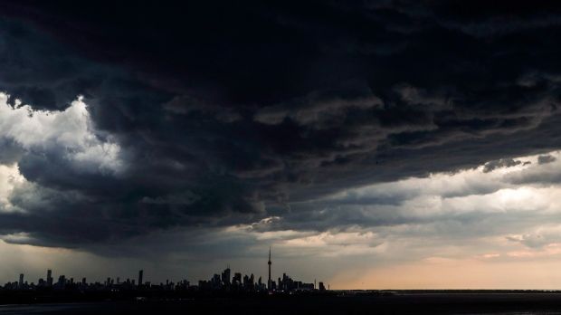
A severe thunderstorm watch and a rainfall warning has been issued for Toronto and others parts of the GTA this afternoon with Environment Canada warning of torrential downpours and a risk of tornadoes.
Thunderstorms are expected to develop this afternoon, the national weather agency said, noting that hazardous conditions, including wind gusts of up to 90 km/h, nickel to toonie-sized hail, and torrential downpours are possible.
Environment Canada’s advisory indicated that tornadoes “cannot be ruled out,” particularly in areas west of the Golden Horseshoe and south of Georgian Bay.
“Large hail can damage property and cause injury. Strong wind gusts can toss loose objects, damage weak buildings, break branches off trees and overturn large vehicles,” the watch read.
“Heavy downpours are likely to cause flash floods and water pooling on roads.”
On Saturday evening, Environment Canada issued a separate rainfall warning across the GTA.
"A slow moving area of showers of thunderstorms has developed from near Fergus to Pickering," the advisory read.
Impacted areas include Vaughan, Markham, Pickering, Fergus, Elora, Woodbridge, North York, Ennotville, Oustic, Brucedale, Ballinafad, Cheltenham, Mayfield, East Brampton, Malton, Rexdale, Concord, Thornhill, Highway 401 at Highway 404 and Unionville.
"Local rainfall amounts of near 50 mm are possible over just a few hours," the rainfall warning read.


