Hurricane Kristy becomes first category 5 storm without El Niño ...
Published on Oct. 25, 2024, 12:42 AM
Hurricane Kristy has become the strongest hurricane in the eastern Pacific basin but will bear no threat to land as it continues its course
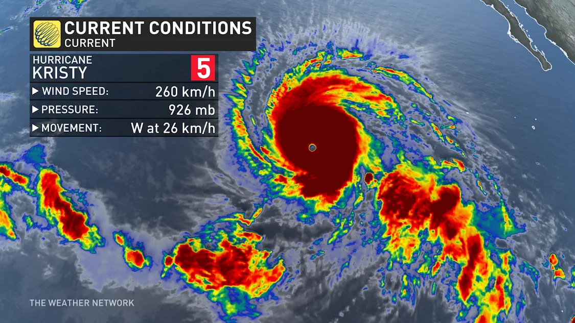
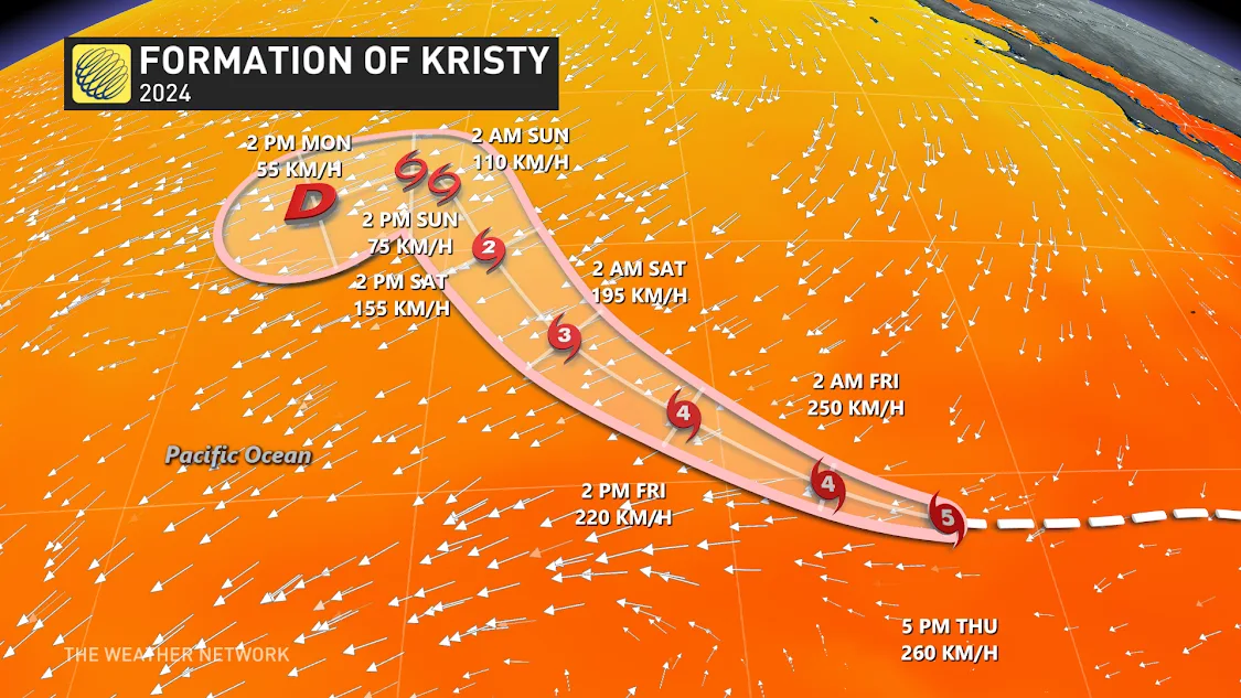
Hurricane Kristy strengthened into a Category 5 hurricane in the Pacific Ocean on Thursday evening, becoming the first hurricane to do so without an El Niño since Hurricane Celia in 2010.
This is a pretty interesting feat, as typically with an El Niño, you have warmer water on the east Pacific and also lower wind shear, lending to easier development of stronger storms.
Kristy is currently churning below the southern tip of the Baja California peninsula of Mexico, with maximum sustained winds of 260 km/h. While the system will bear no threat to land, large swells could be expected across the Baja Peninsula heading into the weekend.
RELATED: Keep up-to-date with hurricane season developments by visiting The Weather Network's hurricane hub.
Kristy joins Beryl and Milton as the other Category 5 storms so far in 2024. Kristy can trace its origins back to Tropical Storm Nadine that made landfall in Belize in mid-October. While Nadine dissipated, the tropical energy traversed westwards across Mexico to fuel Kristy in the Pacific basin.
A similar energy transfer occurred earlier this year when tropical depression Eleven-E made landfall in Mexico, dissipated, and travelled eastward, helping to form Milton, the strongest storm across the globe so far this year.
Kristy is expected to downgrade from its Category 5 status early Friday morning, continuing to downgrade into a tropical depression this weekend.
Header Image courtesy of NOAA.
Stay up to date with the 2024 hurricane season by checking with The Weather Network.


